#201 - 5760 Teredo St
Sechelt, BC V0N 3A0
Canada
Sechelt, BC V0N 3A0
Canada
|
#201 - 5760 Teredo St
Sechelt, BC V0N 3A0 Canada |
|
|
Dionisio Alcalá Galiano:
250th Anniversary of Spanish Explorer's Birth SECHELT, BC — OCTOBER 8, 2010 — Local real estate agent Gary Little has written the following article relating to Spanish explorer Dionisio Alcalá Galiano, who explored Georgia Strait in 1792, on the occasion of the 250th anniversary of his birth. This article appeared in edited form in the October 7, 2010 issue of The Local.
Dionisio Alcalá Galiano (1760-1805) This sea captain, hydrographer, and cartographer was born in Cabra, Spain in 1760. Upon enlisting in the navy in 1779 he learned the fundamentals of hydrography by participating in several surveys of the coast of South America. He later studied astronomy — a required field for hydrographers in those days — at the Royal Observatory in Cádiz under Admiral Vicente Tofiño. It was here that Galiano met Italian Alessandro Malaspina who, under the flag of Spain, would later command an extensive Pacific Ocean scientific expedition from 1789-1794, an expedition designed to rival similar ones conducted by Britain (James Cook) and France (La Pérouse). Malaspina selected his old classmate Galiano to be the expedition's hydrographer, Galiano's first major posting. By the winter of 1791 Malaspina had reached Acapulco, Mexico where he met with Juan Vicente de Güemes, Second Count of Revillagigedo who was Viceroy of New Spain. Revillagigedo told Malaspina of Spain's important discovery the previous July of the inland sea now known as Georgia Strait. This discovery was made by José María Narváez aboard the Santa Saturnina. Malaspina immediately requested that two of his senior officers, Galiano and Cayetano Valdés, be assigned to lead a follow-up expedition. If a northwest passage did exist, reasoned Malaspina, this was where the entrance must be, so he wanted his best men in command. Revillagigedo agreed. Twin ships recently built at the nearby San Blas naval station, Sutil and Mexicana, were fitted out for the voyage and left Acapulco on March 8, 1792. These small 46 ft. ships were goletas, or schooners, rigged as brigs and carried 20 and 21 men, respectively. Galiano commanded the Sutil and Valdés the Mexicana. The ships headed first to Nootka on the west coast of Vancouver Island where Spain had established a small fort in 1789. It was from here that Galiano and Valdés then sailed into Juan de Fuca Strait. As the ships continued north into Georgia Strait, a British ship was spotted near the 49th parallel. This was Chatham, the consort to George Vancouver's flagship Discovery. The British ships had arrived only three days earlier to begin Vancouver's monumental three-year survey of the northwest coast from California to Alaska. Sutil and Mexicana then sailed westward to begin exploring the Gulf Islands, following them up as far as the Nanaimo area. Galiano and Valdés had a close encounter with the Sunshine Coast on June 19, 1792 as their ships moved northward across Georgia Strait from Gabriola Island. Here's what Galiano had to say in his journal about the approach to the north shore of Georgia Strait:
At midday, having remained becalmed, and the current going outward, we decided to anchor. We made way under oars to find an anchorage. The beach, which was sandy, appeared suitable for this. We were a mile from the shore and believed we would be in 25 or 30 fathoms, but found no bottom at 60. We approached the shore and at two thirds of a mile from it, we had 60 fathoms mud. The boat was sent shorewards, and at three cables from the shore there was 30 fathoms gravel. Not being able to overcome the current to any noticeable extent with the oars, we had left off rowing until this was determined, and in the said situation were two miles from the west point of Boca de Carmelo [Howe Sound]. We made our way with the oars to a half mile from the land, and found 40 fathoms, muddy sand bottom. An anchorage so close to land with so much water was all right in case of need, but not as a matter of choice. The thermal breeze started to turn to the west, and not seeing any great force on the water we steered to the east, and with a light southwest wind we continued until four on a steady wind. We came up to ESE. At eight in the evening the wind built up from the west, and we laid a course for the Punta de Lángara [Point Grey].
Alas, a landing at what was probably Bonniebrook Beach near Gibsons did not take place. Instead, the Spanish ended up anchoring off Point Grey where, on the morning of June 21 (June 22 by Vancouver's calendar, his 35th birthday), they had their famous encounter with George Vancouver and Peter Puget who were returning in two longboats from an 11-day intensive survey of Howe Sound and Jervis Inlet.
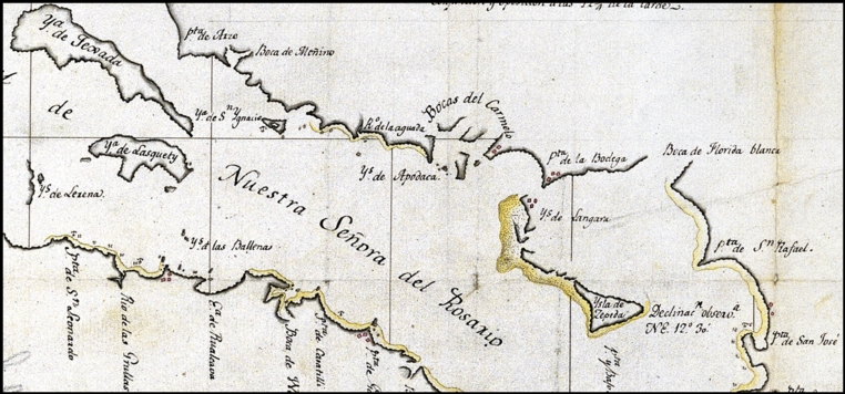
The 1791 Spanish map that mortified George Vancouver in 1792 (Sunshine Coast detail). In a rare display of 18th century diplomacy, these distant representatives of Britain and Spain agreed to team up and work cooperatively to explore the area and to share discoveries. The Spanish did very little surveying on the mainland side of Georgia Strait since that was Vancouver's area of focus. (However, they did discover and chart Indian Arm off Burrard Inlet which Vancouver had ignored.) Instead, they were content with examining the east coast of Vancouver Island. The Spanish chart that was published ten years later incorporates both British and Spanish discoveries as does Vancouver's chart published in 1798.
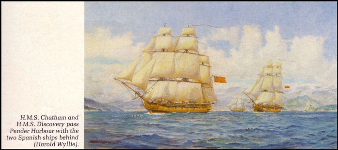
Discovery and Chatham (Vancouver's ships) followed by Sutil and Mexicana (Galiano & Valdés).
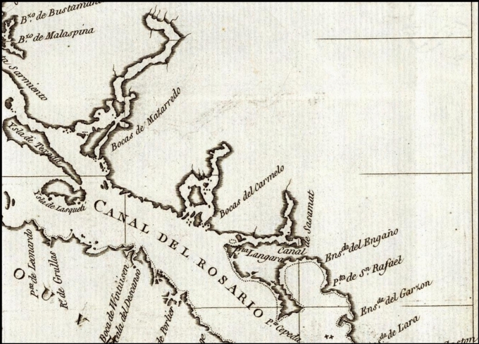
Spanish map of 1802 showing the results of the 1792 Galiano & Valdés survey (Sunshine Coast detail). An account of the Galiano and Valdés expedition was not published for many years because of the expedition's affiliation with Malaspina. Malaspina, who had returned to Spain in 1794 (after 62 months at sea), got himself into political hot water soon afterwards and was imprisoned for sedition in 1796 and exiled to Italy in 1802. As a result, the official description of his expedition was suppressed until 1885, 75 years after his death. However, with some judicious editing, which involved removing all specific references to Malaspina, a description of the Galiano and Valdés discoveries was published in 1802. Although no author credit was given, it appears to be based largely on Galiano's original journal.
Galiano remained in the Spanish navy until his death on October 21, 1805 at the Battle of Trafalgar where the British navy soundly defeated combined French and Spanish naval forces. Galiano was captain of the Bahama and was felled by a cannonball. A more famous casualty that day was Admiral Horatio Nelson, revered then and now as Britain's greatest naval hero. Coincidentally, it was off Nelson Island (so named in 1860 by Capt. George Richards) only 13 years earlier that Galiano had his friendly lunch with the British as their four ships left Sunshine Coast waters.
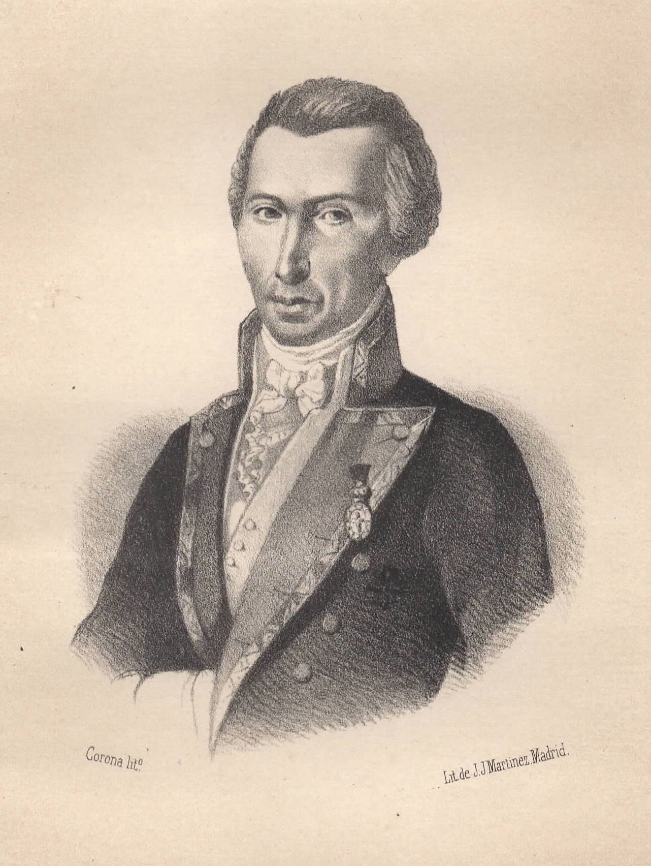
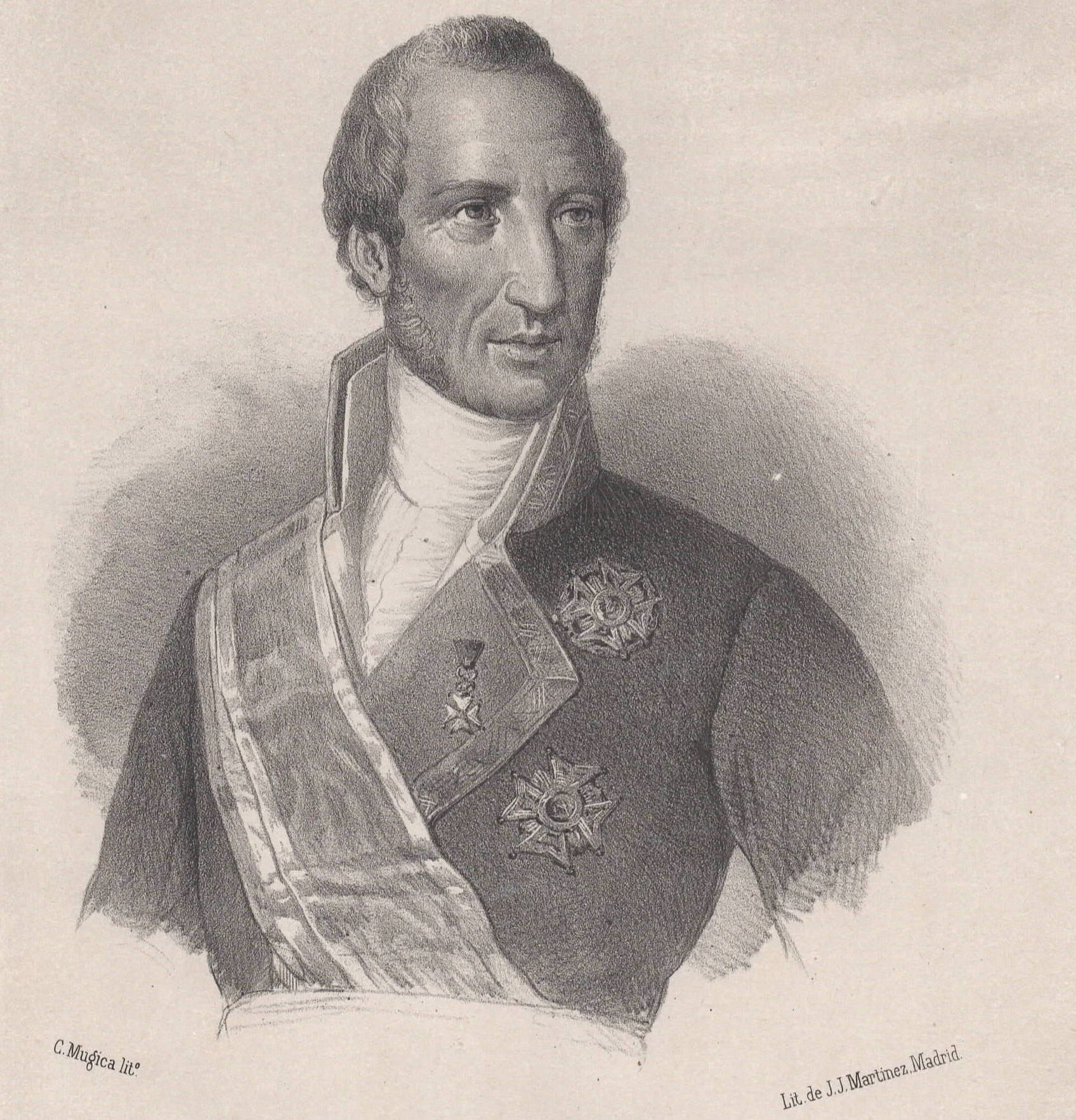
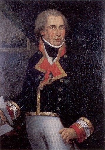
Portraits of Dionisio Alcalá Galiano and Cayetano Valdés (from Historia de la Marina Real Española, Volume II, 1854) Further Reading
— * —
Gary Little is a realtor® and licensed real estate trading services representative in the offices of Royal LePage Sussex in Sechelt, British Columbia, Canada. He is a former senior software marketing manager, having previously worked in Silicon Valley for almost 20 years at the worldwide headquarters of Apple Inc. and Sun Microsystems, Inc. He is well known for his interactive real estate map of the Sunshine Coast (map.garylittle.ca).
—30—
CONTACT INFORMATION
Gary Little, realtor® This news release is located online at: http://www.GaryLittle.ca/maps-historic/galiano.html |