#201 - 5760 Teredo St
Sechelt, BC V0N 3A0
Canada
Sechelt, BC V0N 3A0
Canada
|
#201 - 5760 Teredo St
Sechelt, BC V0N 3A0 Canada |
|
|
Were Americans the First to Visit the Sunshine Coast in 1789?
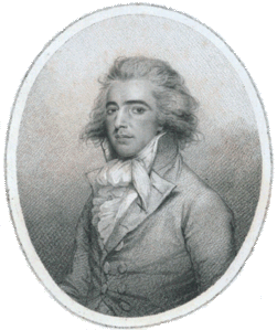
John Meares 1756-1809 SECHELT, BC — JANUARY 15, 2010 — Local real estate agent Gary Little has written the following article relating to a chart that appeared in northwest fur trader John Meares' book of 1790. It suggests there may have been a 1789 visit by Americans to the Sunshine Coast, two years before the Spaniards arrived. This article appeared in the April 2010 issue of Harbour Spiel. Could the first visitors to the Sunshine Coast have been American? Although it seems well established that the Spanish were the first Europeans to sail along our coast in 1791 — they even went ashore near Mission Point in Davis Bay — an intriguing chart from a 1790 book by John Meares hints that a merchant ship from Boston, Mass. may have been the first in the neighbourhood. John Meares, a former Royal Navy lieutenant, was an entrepreneurial fur trader — and part time explorer — on the northwest coast of America in the late 18th century. He was seeking his fortune after reading the official account of Capt. James Cook's third voyage (published in 1784), noting the high prices fetched in China for the sea otter pelts acquired inexpensively during Cook's one month stay at Nootka Sound on Vancouver Island in 1778. Meares' activities brought him to Alaska over the winter of 1786-87 (a harsh season he barely survived) and then to the west coast of Vancouver Island in 1788. In 1790, following his return to England, he wrote a popular book about his adventures titled Voyages Made in the Years 1788 and 1789, from China to the North West Coast of America. The book would later be carried to the northwest coast as a reference by none other than George Vancouver who left England in 1791 with orders to chart the "backside of America" in detail from California to Alaska. Meares' book included the chart shown here, A Chart of the Interior Part of North America Demonstrating the very great probability of an Inland Navigation from Hudsons Bay to the West Coast. This chart is interesting for two reasons:
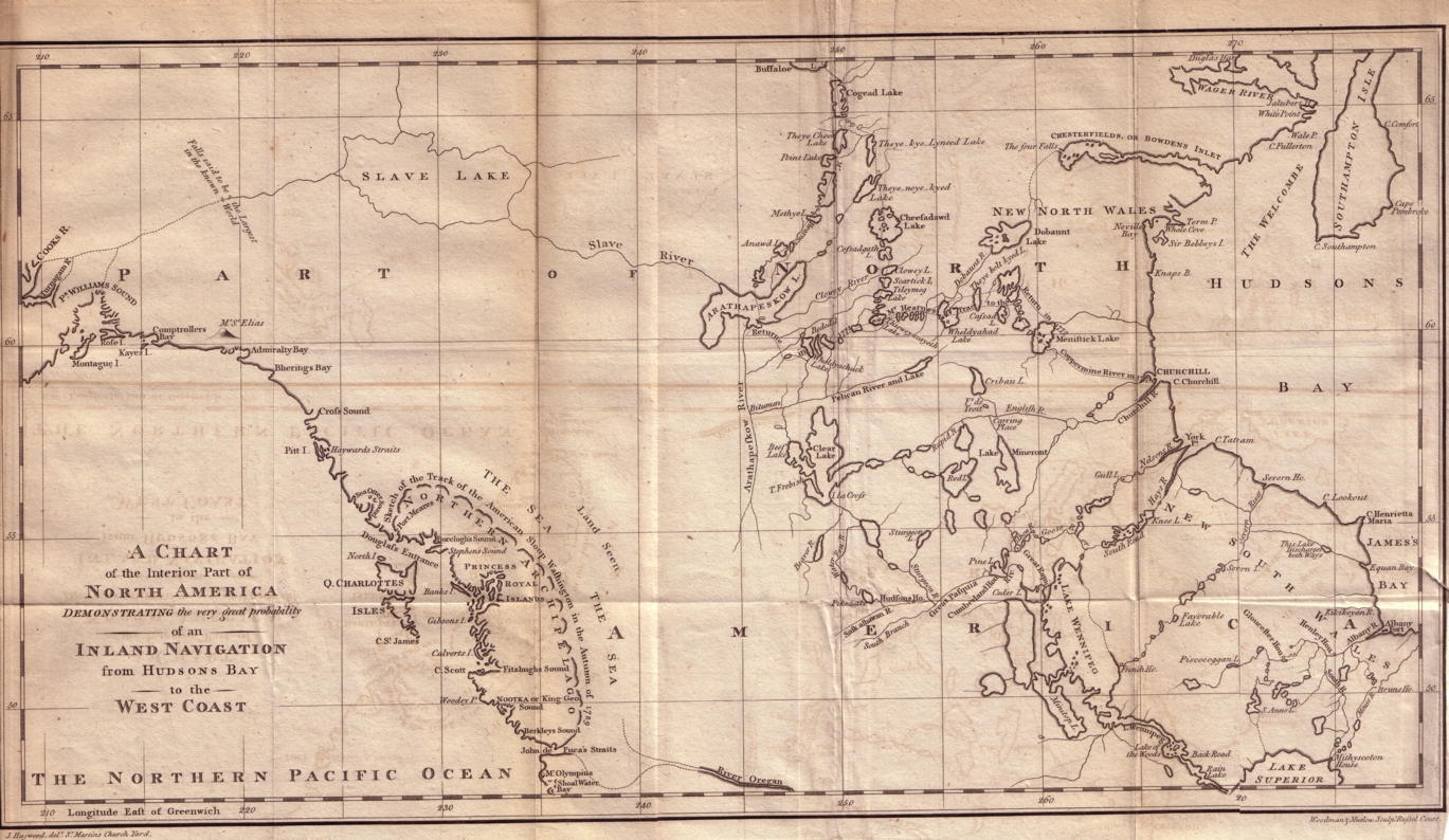
Meares' chart of western Canada (1790) — British Columbia detail. 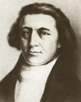
Robert Gray 1755-1806 To understand how this unusual track showed up on the Meares map requires us to go back to Boston in 1787. In that year, only 11 years after the United States Declaration of Independence, several wealthy New England merchants launched a joint venture to tap the same lucrative northwest fur trade market that attracted Meares and others. They outfitted two ships, the Columbia Rediviva and the sloop Lady Washington and put them under the command of Capt. John Kendrick and Capt. Robert Gray, respectively. The plan was to go to Nootka, trade with the natives for sea otter pelts, then head to China to sell them at the high prices Cook had reported.
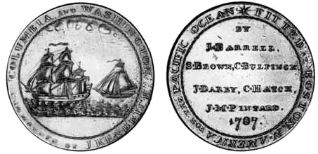
Medal Minted for the Columbia-Washington Voyage of 1787. The Americans wintered at Nootka and accumulated furs until the following summer. Then, in July 1789, the two captains exchanged ships. Gray sailed immediately for China aboard the Columbia Rediviva while Kendrick stayed behind in the Washington, presumably to acquire a few more furs before departing, but the full scope of his activities during that summer and autumn is not known completely. Gray arrived in Macao in November 1789 followed by Kendrick in January 1790. Gray then left for Boston the following month and successfully returned on August 9, 1790, making the Columbia the first American ship to circumnavigate the globe. Kendrick stayed behind in the Washington and never did return to Boston although he continued trading on the northwest coast until his death in Hawaii in December 1794. John Meares had spent the whole of 1789 in Canton managing the affairs of his trading business and, presumably, writing a good portion of the book he would publish the following year. In December 1789 he left for England to personally complain to the government about seizures by the Spanish of his company's ships and land at Nootka. (This precipitated the Nootka Crisis and nearly led to war between Britain and Spain, but that's another story.) Meares' book was a monumental work. It was over 400 pages and included 28 copper-engraved plates and maps, including the map shown here. However, the book was savaged by George Dixon, a rival northwest fur trader of the day (Dixon Entrance north of Haida Gwaii is named for him). He ridiculed Meares for several statements made in his book and alleged that Meares was fraudulently attempting to take credit for discoveries made by others. As for the purported track of the Washington, Dixon said it resembled nothing "so much as the mould of a good old housewife's butter pat" and was a complete fabrication. In a public exchange of pamphlets with Dixon (an 18th century version of an "email flame war"), Meares defended himself by saying that he had obtained his information from "Mr. Neville, a gentleman of the most respectable character, who came home in the Chesterfield, a ship in the service of the East India Company", and that Mr. Neville had "received the particulars of the track" from Captain Kendrick.
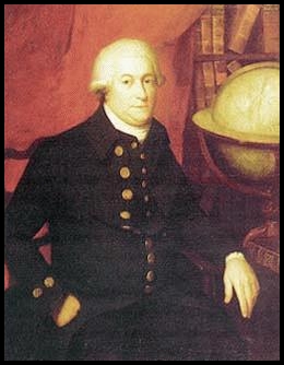
George Vancouver 1757-1798
It is not possible to conceive any one to be more astonished than was Mr. Gray, on his being made acquainted, that his authority had been quoted, and the track pointed out that he had been said to have made in the sloop Washington. In contradiction to which, he assured the officers, that he had penetrated only 50 miles into the straits in question, in an E.S.E. direction; that he found the passage 5 leagues wide; and that he understood, from the natives, that the opening extended a considerable distance to the northward; that this was all the information he had acquired respecting this inland sea, and that he returned into the ocean by the same way he had entered at.
(Two weeks later, on May 11, 1792, Gray would achieve enduring fame as the first to sail into the great river which he named for his ship — the Columbia. This act of discovery was the key to recognition of U.S. claims to the river and to the area north to the 49th parallel in 1846.) An important point that seems to have escaped everyone's attention, however, is that in the autumn of 1789, the time when the Washington was said to have sailed the inland sea, Gray was not the captain of the Washington; he had transferred to the Columbia in late July and sailed her back to China leaving John Kendrick in command of the Washington. Kendrick did more trading, then eventually ended up in Macao in early 1790 after a stopover in Hawaii. Could he have circumnavigated Vancouver Island in the interim? It seems unlikely for a couple of reasons: first, he probably would not have had enough time to do so and, second, such an important achievement would surely have been communicated to many others by Kendrick, who remained an active trader in the north Pacific until his death five years later, but it wasn't. Nevertheless, the possibility of a 1789 voyage around Vancouver Island, however faint, still lingers. As J. Richard Nokes, author of Almost a Hero (a biography of John Meares), says, "It is conceivable that Kendrick may have sailed from Clayoquot Sound through the Strait of Juan de Fuca and then north behind Vancouver Island perhaps to trade with natives near the Queen Charlotte Islands. The truth will never be known, because Kendrick died in Hawaii in 1794 without ever returning to Boston, and any record concerning this incident was lost or has never been found." One thing is certain: If Meares' assertion was correct — and if Kendrick had a better publicist — most of present-day British Columbia would have become American territory faster than you can say "Fifty-Four Forty or Fight!" Further Reading
— * —
Gary Little is an innovative real estate agent in the offices of Royal LePage Sussex in Sechelt, British Columbia. He is well known for his use of technology to provide compelling real estate tools for the general public, notably his interactive real estate map of the Sunshine Coast, his real estate statistics service, and his real estate services for mobile phone users.
— 30 —
CONTACT INFORMATION
Gary Little, realtor® This news release is located online at: http://www.GaryLittle.ca/maps-historic/meares.html |